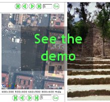
What's JourneySat?JourneySat lets you show to your friends and relatives the places you've travelled to. You can combine diary notes, photos and satellite images and embed them into your web site either when you're back home or when you're still on the road. After writing a diary note and adding the photos of the day, you can find out the exact geographical location of the places you've visited to let your friends see them from a satellite viewpoint, using the images provided by Google Maps TM. In this way they'll see much more than what can be normally experienced through photos. As a further bonus, you can even specify the locations where you shoot your photos and they'll be marked on the satellite view. And, well, why limit oneself to documenting travels? You can use JourneySat for anything that you can see on the planet Earth. One more word before directing you to the demo: JourneySat is free software. That means both that it costs no money and that you can modify it as you wish. JourneySat is licensed under the GNU General Public License. Read the terms of the license. |
DemoDownloadYou can download JourneySat from here. The current version is 1.1.2 Read the documentation to use it your web site and to create your first travel diary. |

